Summary
A return to drier weather conditions from 2017 has affected some wetland areas and waterbird breeding, but has been mitigated in those inland communities receiving environmental water.
Widespread rain and flooding during 2016 inundated many wetlands, increasing waterbird breeding. From 2017, drier weather has reduced the extent of wetland inundation and decreased waterbird breeding.
Inland wetlands that have received environmental water (water held by the government and released in areas that need it) have maintained vegetation condition and waterbird diversity, with many acting as refuges for water-dependent species during dry periods.
Wetland condition is affected by dry weather, decreased water availability, changed patterns of river and tidal flows and surrounding land uses, for example, runoff from agriculture, construction and mining can affect wetland health.
Inland wetland health is being maintained by releases of environmental water and the implementation of the 2012 Murray–Darling Basin Plan. Coastal wetland health is anticipated to have renewed emphasis because of actions being carried out under the NSW Coastal Management Act 2016 and NSW Marine Estate Management Act 2014.
Related topics: Water Resources | River Health
NSW indicators
| Indicator and status | Environmental trend |
Information reliability |
|
|---|---|---|---|
| Wetland extent |
|
Getting worse | ✔ |
| Wetland condition |
|
Getting worse | ✔ |
| Waterbird abundance and diversity |
|
Getting worse | ✔✔✔ |
Notes:
Terms and symbols used above are defined in How to use this report.
Context
Wetlands are areas of land covered or saturated with fresh, brackish or salt water that is generally still or slow moving. The water can also sit just below the land’s surface. An area does not need to be permanently wet to qualify as a wetland, but just wet for long enough for its plants and animals to have adapted to – or even depend on – wet conditions for at least part of their life cycles.
Wetlands can be classified into five types:
- riverine wetlands, around freshwater rivers, creeks, streams and other waterways
- lacustrine wetlands, around freshwater lakes and reservoirs
- palustrine wetlands, which are inland freshwater areas with plenty of trees and other vegetation
- estuarine wetlands, around estuaries
- marine wetlands, along the coast.
In 2004, approximately 5.6% of NSW was mapped as wetland (Kingsford et al. 2004).
Wetland ecosystems:
- support high levels of biodiversity, providing habitat for a wide range of animals including waterbirds, fish, frogs, turtles, invertebrates and water-dependent plants
- contribute to regional economies by providing environments for commercial fisheries, grazing and tourism
- provide habitat for threatened animals including the freckled duck, Australasian bittern, green and golden bell frog and southern pygmy perch (Fisheries Management Act 1994; Biodiversity Conservation Act 2016)
- are home to threatened ecological communities such as coastal saltmarsh
- provide important stopover and winter habitat for many migratory birds protected under bilateral international agreements and the Bonn Convention (Convention of the Conservation of Migratory Species of Wild Animals).
Wetlands also play a key role in keeping the environment healthy by:
- contributing to the biogeochemical cycling of gases such as methane and carbon dioxide, and nutrients
- regulating regional hydrological cycles and climate
- reducing the impact of storm damage and flooding
- maintaining good water quality in rivers
- recharging groundwater.
Wetlands are culturally significant for Aboriginal people and provide them with a strong connection to country.
Status and Trends
Long term surveys
The basis for assessing trends in wetland extent and waterbird populations is the long-running (1983–2017) annual Eastern Australian Waterbird Survey. In October each year, 10 aerial surveys covering areas 30 kilometres wide at every two degrees of latitude across eastern Australia are undertaken to monitor up to 2,000 wetlands and provide estimates for 50 species of waterbird (Porter et al. 2017). The survey includes every body of water larger than one hectare in width and length, including estuaries, coastal lakes, rivers, swamps, floodplain wetlands, saline lakes, dams, reservoirs and impoundments.
The wetland area index is the sum of all the inundated wetland areas measured over the 10 aerial survey bands, rather than the actual total area, which is why it is referred to as an index. It is assumed to be a representative sample of all the wetlands and is comparable from year to year since the aerial survey bands are consistent through time. The waterbird abundance index, breeding index and breeding species diversity index are also summations over the 10 aerial survey bands.
Wetland extent and condition
Figure 18.1: Estimated wetland area in eastern Australia, 1983–2017
Notes:
Data from annual aerial survey in 10 NSW wetland areas, 1983–2017.
Widespread rainfall across 2010–11 and 2011–12 and in 2016 inundated many floodplain wetlands across inland NSW and initiated the recovery of wetland vegetation from the drying effects of the millennium drought of 2003 to 2009 (OEH 2015a). The improvement in wetland vegetation has continued where environmental water can be delivered (OEH 2016; OEH 2017).
Over the past decade, monitoring across inland valleys receiving environmental water has indicated an improvement in the condition of wetland vegetation communities compared with their condition near the end of the millennium drought in 2008 (DECCW 2010b; DECCW 2010c; DECCW 2011a; DECCW 2011b; Wen & Saintilan 2015; Bowen et al. 2018b). This improvement is due to both natural flooding and delivery of environmental water. Where monitoring for the period 2015–17 is available, overall vegetation condition either remained steady or showed some further improvement (OEH 2016; OEH 2017).
For example, in the Macquarie Marshes, vegetation condition improved between 2015 and 2017, mostly in response to flooding in late 2016 (Figure 18.2).
The score for vegetation condition in Figure 18.2 is determined using a methodology (Bowen et al. 2018a) where the maximum score possible is 20. Scores for vegetation condition in 2015–17 in the Macquarie Marshes were intermediate to good (Bowen et al. 2018b). Vegetation communities that improved in condition during this period included lignum shrublands, river red gum forests and woodlands, and coolabah woodlands. The condition of other vegetation such as mixed marsh, water couch and reed beds remained steady.
Monitoring of vegetation communities in the Gwydir Wetlands indicated steady condition scores overall between 2015 and 2017 (OEH 2017). Marsh club rush and mixed marsh improved while river cooba and coolabah forests showed little change in condition (Spencer et al. 2017, unpublished data).
Despite the improvement in vegetation condition in inland wetland areas receiving environmental water, areas without adequate water have still not recovered to pre-drought conditions (OEH 2015b; OEH 2016; OEH 2017).
Figure 18.2: Condition score for all flood dependent monitoring sites in Macquarie Marshes
The recent threat and risk assessment of NSW marine areas identified statewide priority threats to coastal wetlands, which were:
- clearing riparian habitat, including draining wetlands
- estuary entrance modification (BMT WBM 2017).
The negative outcomes of these threats are water pollution, physical disturbance and wildlife disturbance. In some locations:
- clearing and draining have led to acid runoff and black water (depletion of dissolved oxygen levels) after floods
- entrance modifications have resulted in changes to tidal flow velocity and patterns, altering water tables and connectivity
- both threats have permanently decreased some shorebird habitat through dryness or erosion.
Related topic:
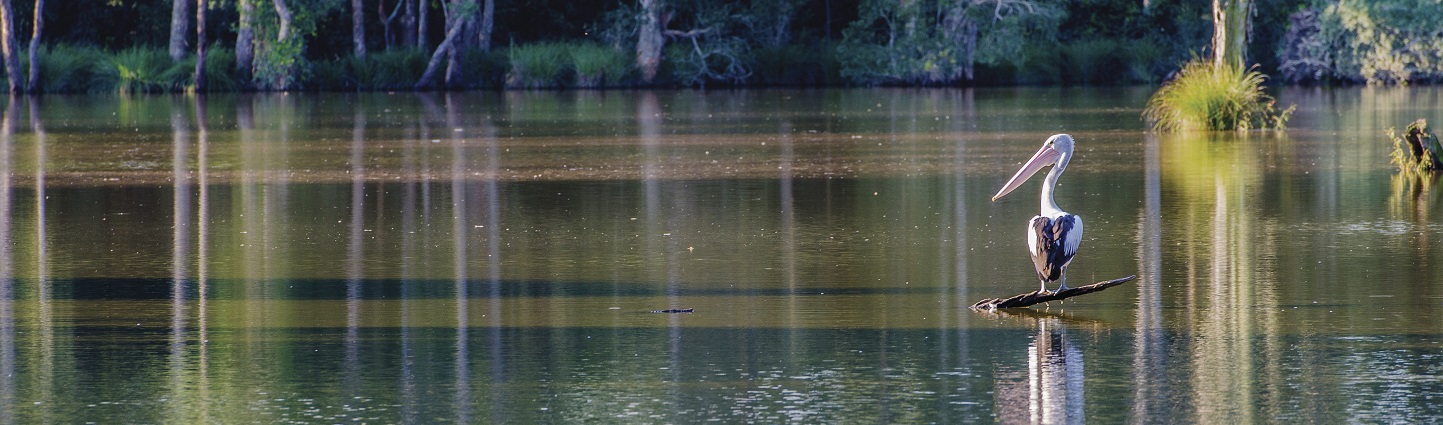
Waterbirds
Wetlands provide important waterbird habitat, supporting breeding and foraging. The Eastern Australian Waterbird Survey showed that the total breeding index was low in 2015 and 2017, well below the long-term median, although it increased in 2016 in response to widespread natural flooding (Porter et al 2015; Porter et al 2016; Porter et al. 2017) (see Figure 18.3a). May–September 2016 was the wettest period on record across much of south-east Australia, with September 2016 being the wettest period on record for NSW.
In 2017, the total waterbird abundance index increased considerably from 2016 but remained below the long-term median. The waterbird breeding species richness index was also low, with only six species recorded breeding (Figure 18.3b). The number of birds for each game species in 2017 was well below long-term medians, in many cases by an order of magnitude, save for the grey teal which recorded numbers of birds near the long-term median (Porter et al. 2017).
Figure 18.3a: Estimated waterbird abundance index (‘000) in eastern Australia, 1983–2017
Notes:
Data from annual aerial survey in 10 NSW wetland areas, 1983–2017.
Figure 18.3b: Waterbird Breeding index (‘000) in eastern Australia, 1983–2017
Notes:
Data from annual aerial survey in 10 NSW wetland areas, 1983–2017.
Figure 18.3c: Waterbird breeding species diversity in eastern Australia, 1983–2017
Notes:
Data from annual aerial survey in 10 NSW wetland areas, 1983–2017.
Despite some increase in breeding abundance and species diversity for 2015–17, there is a continued long-term reduction in these indices of waterbird populations, reflecting the lack of suitable inundated habitat due to declines in annual river flows across the Murray–Darling Basin. In comparison, there is no long-term decline in waterbird populations in the less developed Lake Eyre Basin (Kingsford et al. 2017).
Recent research also indicates that migratory waterbird habitat is declining across East Asia (a major stopover for many migratory waterbird species en route to Australia) and this is also affecting shorebird populations (Murray & Fuller 2015).
Monitoring results across the State’s inland wetlands show that other wetland-dependent animals have benefited from the delivery of environmental water. An example is the nationally vulnerable southern bell frog, with populations expanding into new wetland sites in the Murrumbidgee and Murray catchments (Wassens et al. 2017).
Wetlands added to national parks, regional parks and reserves
Tables 18.1a and 18.1b summarise the 1,451.7 hectares of wetland that were added to NSW national parks, regional parks and reserves in 2015–17.
Table 18.1a: Extent of wetland types and their inclusion in NSW reserves, 2017: Coastal wetlands
| Wetland type | Total area in NSW (ha) | Total area in NSW parks estate (ha) (% of total) | Additions of wetland to NSW parks estate in 2015–17 (ha) | Examples of new areas of wetland declared or added to NSW parks estate in 2015–17 |
|---|---|---|---|---|
| Floodplain wetlands | 15,429 | 4,349 (28%) | 68.6 | Everlasting Swamp National Park (addition to existing reserve: 66.7ha) Yellomundee Regional Park (addition to existing reserve: 1.0ha) Captains Creek Nature Reserve (addition to existing reserve: 0.9ha) |
| Freshwater wetlands | 2,095 | 235 (11%) | – | – |
| Estuarine wetlands | 111,527 | 14,873 (13%) | 33.6 | Coffs Coast Regional Park (addition to existing reserve: 2.2ha) Hunter Wetlands National Park (addition to existing reserve: 1.8ha) Cobaki Nature Reserve (14.7ha, new reserve gazetted January 2016) Gaagal Wanggaan (South Beach) National Park (addition to existing reserve: 14.7ha) Wolli Creek Regional Park (addition to existing reserve: 0.16ha) Lake Macquarie State Conservation Area (addition to existing reserve: 0.06ha) |
| Coastal lakes and lagoons | 66,590 | 18,775 (28%) | 0.5 | Lake Macquarie State Conservation Area (addition to existing reserve: 0.5ha) |
| Total | 195,641 | 38,232 (20%) | 102.7 | – |
Table 18.1b: Extent of wetland types and their inclusion in NSW reserves, 2017: Inland wetlands
| Wetland type | Total area in NSW (ha) | Total area in NSW parks estate (ha) (% of total) | Additions of wetland to NSW parks estate in 2015–17 (ha) | Examples of new areas of wetland declared or added to NSW parks estate in 2015–17 |
|---|---|---|---|---|
| Floodplain wetlands | 4,008,839 | 272,210 (7%) | 1,349 | Kalyarr National Park (addition to existing reserve 1,105 ha) Culgoa National Park (addition to existing reserve 244 ha) |
| Freshwater lakes | 296,071 | 21,026 (7%) | – | – |
| Saline lakes | 18,542 | – | – | – |
| Total | 4,323,452 | 293,236 (7%) | 1,349 | – |
Coastal wetlands
In 2015–17, coastal wetlands in the NSW public reserve system increased by 102.7 hectares. Substantial additions included the new Cobaki Nature Reserve and additions to Everlasting Swamp National Park and Gaagal Wanggaan (South Beach) National Park, all located on the NSW North Coast.
Cobaki Nature Reserve lies on the Tweed River estuary and protects important remnants of coastal lowland forest in an area of rapidly expanding urban and infrastructure development. Mangroves and saltmarsh occur on intertidal estuarine mud and cover 11% of the reserve, while swamp sclerophyll forest dominated by stands of swamp oak covers 21%.
Everlasting Swamp National Park, 15 kilometres west of Maclean, lies on the Clarence River floodplain, and is part of one of the largest coastal floodplain wetlands remaining in NSW.
Inland wetlands
In 2015–17, 1,349 hectares of inland wetland were added to the NSW public reserve system. This included an addition to Kalyarr National Park of 1,105 hectares. This park, on the Lachlan River, protects inland freshwater aquatic ecosystems and diverse species including migratory birds. Much of the wetland reserved is listed in A Directory of Important Wetlands in Australia.
Pressures
Water availability
Water availability is the most significant pressure on the health of many wetland ecosystems. Altered flows from water extraction and the building of dams, levees and diversion structures has had long-term and ongoing negative effects on water availability, especially for important waterbird breeding sites such as Macquarie Marshes and Lowbidgee wetlands. Many inland wetlands have had prolonged periods of reduced water availability.
See the Water Resources topic for more information about water resource extraction and diversion.
Climate change
Wetlands in NSW, and the animals and plants that depend on them, are vulnerable to the impacts of climate change. Altered flow regimes and extreme weather such as heatwaves and droughts will decrease water availability through rising temperatures increasing rates of evapotranspiration and altering rainfall patterns. This ultimately impacts on the frequency and duration of wetland inundation.
Coastal freshwater wetlands that rely on rainfall are likely to be negatively affected by climate change. Rising sea levels will alter tidal ranges and inundation in estuaries, reducing water flowing into coastal saline wetlands (DECCW 2010a, BMT WBM 2017).
Water quality
Human activities may adversely affect wetland water quality. Examples include:
- Vegetation clearing in NSW is resulting in far more sediment entering wetlands. Sediment can form muddy deposits, reduce light penetration and smother plants and animals.
- The amount of saline water discharged from mines is increasing in areas such as the Hawkesbury–Nepean and Hunter regions and is affecting the health of streams and the wetlands they flow into (EPA 2013; OEH 2015c; Price and Wright 2016; Wright et al. 2017).
- Increased urbanisation adds more pollutants such as sediments and nutrients to rivers and streams (MEMA 2017).
- Soil erosion and gullying have led to declines in water quality in the Wingecarribee, Braidwood, Wollondilly, Mulwaree, Upper Wollondilly and Nattai rivers (Alluvium Consulting Australia 2017).
- Diffuse pollution from development, clearing, cropping, grazing, mining and other land uses, and sewage, can lead to increasing levels of nutrients and sediments entering wetlands, resulting in hypoxia or black water (depletion of dissolved oxygen levels), fish kills, excessive plant growth, increased turbidity and siltation.
Physical disturbance
Physical disturbances such as land clearing on the floodplains of inland NSW and mining activity have a major impact on the quality of habitat in, and the extent of, wetlands (see the River Health topic).
Studies have identified impacts linked to longwall mining on upland swamps on the Woronora and Newnes plateaus in the Woronora and Hawkesbury-Nepean catchments (GHD 2013; Alluvium Consulting Australia 2017; Young 2017). Subsidence can fracture the base of swamps and drain groundwater-dependent ecosystems (GHD 2013). Other impacts include changes to site geology through strata fracturing, a reduction in surface water and groundwater quantity and quality, and decreased ecosystem function in wetlands and streams (GHD 2013; Alluvium Consulting Australia 2017; Young 2017). The 2016 Sydney Drinking Water Catchment Audit (Alluvium Consulting Australia 2017) found surface water flows were decreasing, associated with the cumulative impacts of underground coal mining.
Invasive species
The spread of weed and pest species is facilitated by physical disturbances to wetlands, altered flow regimes and drainage and increased nutrient load. Aquatic weed species in NSW wetlands include lippia, salvinia and water hyacinth (see the State of the catchments reports).
Introduced plants can:
- result in poorer habitat value for native animals
- increase sedimentation
- create monocultures which reduce overall biodiversity.
Introduced plants can reflect the degree of degradation or restorability of a wetland.
Invasive pest species also cause problems. Introduced aquatic species such as carp and mosquito fish can decimate native fish populations in wetlands and affect water quality.
Trampling and digging by grazing animals has extensively damaged wetland vegetation, soils and channels and river banks. Many feral animals such as cats, foxes and pigs prey on small native animals and birds, and their young (see the Invasive Species topic).
Responses
Legislation and policy
Key policies and legislation include:
- the NSW Wetland Policy
- protection for some wetlands under the NSW Reserve system (National Parks and Wildlife Act 1974) or through conservation agreements with private landholders
- State Environmental Planning Policy - Coastal Management 2018 and the Biodiversity Conservation Act 2016, which protects wetlands listed as endangered ecological communities
- The Coastal Management Act 2016 and the coastal management framework which includes coastal wetlands within its scope of management and grants
- the Ramsar Convention and Environment Protection and Biodiversity Conservation Act 1999 (Commonwealth), which help protect 13 internationally significant wetlands in NSW
- environmental water holdings in five valleys in the Murray–Darling Basin which help to improve the ecological condition of floodplain wetlands (see the Water Resources topic)
- the Water Management Act 2000, which outlines requirements for water-sharing plans and floodplain management plans to manage and protect wetlands along NSW rivers and on their floodplains.
The NSW Wetlands Policy (DECCW 2010a) promotes the sustainable conservation, management and use of wetlands. Some wetlands are protected under the NSW Reserve system (National Parks and Wildlife Act 1974) or through conservation agreements with private landholders. Additional significant wetlands in NSW include those mapped under State Environmental Planning Policy – Coastal Management 2018.
The Biodiversity Conservation Act 2016 and Environment Protection and Biodiversity Conservation Act 1999 (Commonwealth) protect threatened species and endangered ecological communities in wetlands.
The Ramsar Convention and Environment Protection and Biodiversity Conservation Act help protect internationally significant wetlands. NSW has 12 Ramsar wetlands: Blue Lake, Fivebough and Tuckerbil Swamps, Gwydir Wetlands, Hunter Estuary Wetlands, Lake Pinaroo (Fort Grey Basin), Little Llangothlin Nature Reserve, Macquarie Marshes, Myall Lakes, Narran Lake Nature Reserve, NSW Central Murray Forests, Paroo River Wetlands and Towra Point.
The Water Management Act 2000 outlines requirements for water-sharing plans for NSW rivers, which are one of the most important mechanisms for protecting wetlands. Floodplain management plans help protect and restore wetlands on floodplains.
To address the potential effects of underground mining activities on wetlands in the Woronora and Hawkesbury-Nepean catchments, the NSW Government places strict controls on mining to protect the integrity of the catchments and its water storages. The Government has also established an Independent Expert Panel to review and monitor existing mining in the catchments, and introduced an Aquifer Interference Policy to protect underground water sources.
Programs
Water to restore and maintain wetlands
The NSW Office of Environment and Heritage manages environmental water in five valleys in the Murray–Darling Basin (Lachlan, Macquarie-Castlereagh, Gwydir, Murrumbidgee and NSW Murray), in part to improve the ecological condition of floodplain wetlands (see the Water Resources topic).
The Environmental Water Management Program (EWMP) aims to rehabilitate wetland habitat for significant water-dependent plants and animals, including floodplain eucalypts, waterbirds, frogs, reptiles and fish.
The EWMP evolved from a need to address long-held concerns about the health of floodplain wetlands in the Murray–Darling Basin. The NSW Government purchased environmental water from willing sellers under NSW RiverBank, the Rivers Environmental Restoration Program and the NSW Wetland Recovery Program.
The Commonwealth Government now holds water for the environment across the Murray–Darling Basin to ensure sustainable limits set by the 2012 Murray–Darling Basin Plan are met by 2019.
Water quality
NSW Government initiatives that protect and improve wetland water quality include:
- those being funded under the NSW Government’s $112 million Catchment Action NSW initiative
- the $46 million Marine Estate Management Strategy 2018–2028 (MEMA 2018)
- coastal management planning and grants for estuarine wetlands under the NSW Coastal Management Framework.
Related topics: River Health | Coastal Estuarine and Marine Ecosystems
Future opportunities
NSW wetlands inventory
While wetland inventories for areas of NSW exist (Kingsford et al. 2004; Powell et al. 2017), many NSW wetlands are not on currently available maps or in spatial data, due to the variety of mapping methods used, the scale of the mapping or the climate regime at the time of assessment. This limits the ability to report on their condition and extent or undertake a statewide vulnerability assessment. As a result, Office of Environment and Heritage is building a comprehensive inventory of all wetlands in NSW to improve the way wetlands are monitored and managed. This information will be then passed to the public.
A wetlands inventory pilot project for the Lachlan River catchment was completed in 2016–17. This region was selected due to:
- opportunities for community engagement
- availability of data
- feasibility, given limited timeframes.
The pilot project showed the value of consistently mapping all inland wetlands to improve available information on their location, extent and condition (Powell et al. 2017). When funding is available, more catchments will be mapped using the tools developed during the pilot project.
Marine Estate Management Strategy
An extensive statewide threat and risk assessment of marine areas in NSW, including coastal wetlands, was completed in 2017 (BMT WBM 2017). The Marine Estate Management Strategy (MEMA 2018) responds to the priority threats identified in the threat and risk assessment, and provides an overarching framework for managing the marine estate as a single continuous system over the next decade. Objectives in the strategy include:
- protecting and rehabilitating coastal wetlands and habitats (BMT WBM 2017)
- understanding ways of managing the threat of sea level rise on estuarine wetlands
- protecting threatened species and ecological communities listed in the Fisheries Management and Biodiversity Conservation Acts (MEMA 2017).
References
References for Wetlands
Alluvium Consulting Australia 2017, 2016 Audit of the Sydney Drinking Water Catchment [www.waternsw.com.au/about/legislation/catchment-audits]
BMT WBM 2017, New South Wales Marine Estate Threat and Risk Assessment Report: Final Report, NSW Marine Estate Management Authority [www.marine.nsw.gov.au/__data/assets/pdf_file/0010/736921/NSW-Marine-Estate-Threat-and-Risk-Assessment-Final-Report.pdf (PDF 5MB)]
Bowen S, Honeysett J, Simpson SL, Hosking T, Shelly D, Keyte P, Heath J, Kobayashi T, Humphries J, Thomas R, Karunaratne S, Kuo W & Jones H 2018a, Developing condition classes for flood-dependent vegetation: a case study in the Macquarie Marshes, NSW Office of Environment & Heritage: Healthy Inland Wetlands and Environmental Water Program, Sydney
Bowen S, Simpson S, Shelly D, Honeysett J, Hosking T, Humphries J & Kuo W 2018b, Monitoring the condition of water-dependent vegetation communities of the Macquarie Marshes 2008–2017, NSW OEH Healthy Inland Wetlands and Environmental Water Program, Sydney
DECCW 2010a, NSW Wetlands Policy, Department of Environment, Climate Change and Water, Sydney [www.environment.nsw.gov.au/wetlands/NSWWetlandsPolicy.htm]
DECCW 2010b, Macquarie Marshes Adaptive Environmental Management Plan: Synthesis of information projects and actions, Department of Environment, Climate Change and Water, Sydney [www.environment.nsw.gov.au/environmentalwater/macquarie-priorities.htm]
DECCW 2010c, NSW Wetland Recovery Program: Final Report, NSW Department of Environment, Climate Change and Water, Sydney
DECCW 2011a, Gwydir Wetlands Adaptive Environmental Management Plan: Synthesis of information projects and actions, Department of Environment, Climate Change and Water, Sydney [www.environment.nsw.gov.au/environmentalwater/gwydir-priorities.htm]
DECCW 2011b, NSW Rivers Environmental Restoration Program: Final Report, Department of Environment, Climate Change and Water, Sydney [www.environment.nsw.gov.au/environmentalwater/history-context.htm#rerp]
EPA 2013, Hunter Catchment Salinity Assessment: Final Report, Environment Protection Authority, Sydney [https://www.epa.nsw.gov.au/-/media/7AFF4DA407D44002AB6DE0027271FFB5.ashx]
GHD 2013, 2013 Audit of the Sydney Drinking Water Catchment: Volume 1 – Main Report, Water Sciences Group, GHD Group, Sydney [www.parliament.nsw.gov.au/la/papers/Pages/tabled-paper-details.aspx?pk=58219]
Kingsford RT, Brandis K, Thomas RF, Crighton P, Knowles E & Gale E 2004, ‘Classifying landform at broad spatial scales: The distribution and conservation of wetlands in New South Wales, Australia’, Marine and Freshwater Research, 55, pp. 17–31
Kingsford RT, Bino G & Porter JL 2017, ‘Continental impacts of water development on waterbirds, contrasting two Australian river basins: Global implications for sustainable water use’, Global Change Biology, 23(11), pp. 4958–4969, [https://www.ncbi.nlm.nih.gov/pubmed/28578561]
MEMA 2017, NSW Marine Estate Threat and Risk Assessment: Background environmental information, Marine Estate Management Authority [https://www.marine.nsw.gov.au/__data/assets/pdf_file/0006/672198/NSW-Marine-Estate-Threat-and-Risk-Assessment-background-environmental-information-TARA-report.PDF (PDF 9.2MB)]
MEMA 2018, NSW Marine Estate Management Strategy 2018–2028, Marine Estate Management Authority [www.marine.nsw.gov.au/__data/assets/pdf_file/0007/815596/Marine-Estate-Management-Strategy-2018-2028.pdf (PDF 12.6MB)]
Murray, NJ & Fuller, RA 2015, ‘Protecting stopover habitat for migratory shorebirds in East Asia’, Journal of Ornithology, 156(Suppl. 1), pp. 217–225 [dx.doi.org/10.1007/s10336-015-1225-2]
OEH 2015a, An evaluation of the NSW environmental water management program 2006–2013, Office of Environment & Heritage, Sydney [www.environment.nsw.gov.au/research-and-publications/publications-search/evaluation-of-the-nsw-environmental-water-management-program-2006-to-2013]
OEH 2015b, Environmental water use in New South Wales: Outcomes 2014–15, Office of Environment & Heritage, Sydney [www.environment.nsw.gov.au/research-and-publications/publications-search/environmental-water-use-in-new-south-wales-outcomes-2014-15]
OEH 2015c, Clarence Colliery Discharge Investigation, Office of Environment & Heritage, Sydney [www.epa.nsw.gov.au/~/media/EPA/Corporate%20Site/resources/licensing/150171-clarence-colliery-discharge-investigation.ashx]
OEH 2016, Environmental water use in New South Wales: Outcomes 2015–16, Office of Environment & Heritage, Sydney [www.environment.nsw.gov.au/research-and-publications/publications-search/environmental-water-use-in-nsw-outcomes-2015-16]
OEH 2017, Use of water for the environment in New South Wales: Outcomes 2016–17, Office of Environment & Heritage, Sydney [www.environment.nsw.gov.au/research-and-publications/publications-search/use-of-water-for-the-environment-in-nsw-outcomes-2016-17]
Porter JL, Kingsford RT & Brandis K 2015, Aerial Survey of Wetland Birds in Eastern Australia: October 2015 Annual Summary Report, Centre for Ecosystem Science, School of Biological, Earth and Environmental Sciences, University of NSW, Sydney [www.ecosystem.unsw.edu.au/content/rivers-and-wetlands/waterbirds/eastern-australian-waterbird-survey]
Porter JL, Kingsford RT & Brandis K 2016, Aerial Survey of Wetland Birds in Eastern Australia: October 2016 Annual Summary Report, Centre for Ecosystem Science, School of Biological, Earth and Environmental Sciences, University of NSW, Sydney [www.ecosystem.unsw.edu.au/content/rivers-and-wetlands/waterbirds/eastern-australian-waterbird-survey]
Porter JL, Kingsford RT & Brandis K 2017, Aerial Survey of Wetland Birds in Eastern Australia: October 2017 Annual Summary Report, Centre for Ecosystem Science, School of Biological, Earth and Environmental Sciences, University of NSW, Sydney [www.ecosystem.unsw.edu.au/content/rivers-and-wetlands/waterbirds/eastern-australian-waterbird-survey]
Powell M, Hodgins G, Cowood A, Ling J, Wen L, Tierney D & Wilson C 2017, Building a NSW Wetland Inventory: Lachlan River Catchment wetland mapping methods, NSW Office of Environment & Heritage, Sydney
Price P & Wright I 2016, ‘Water Quality Impact from the Discharge of Coal Mine Wastes to Receiving Streams: Comparison of Impacts from an Active Mine with a Closed Mine’, Water Air Soil Pollution 2016, 227:155 [doi 10.1007/s11270-016-2854-7]
Spencer J, Ocock J, Amos C, Hosking T, Humphries J, Borrell A, Suter S, Preston D, Hutton K & Berney P 2017, Monitoring Waterbird Outcomes in NSW: Summary Report 2016–17, Unpublished report, NSW Office of Environment & Heritage, Sydney
Wassens S, Spencer J, Thiem J, Wolfenden B, Thomas R, Jenkins K, Brandis K, Lenon E, Hall A, Ocock J, Kobayashi T, Bino G, Heath J & Callaghan D 2017, Commonwealth Environmental Water Office Long-Term Intervention Monitoring Project Murrumbidgee River System Selected Area Evaluation Report, 2014–17, report prepared for the Commonwealth Environmental Water Office, Commonwealth of Australia [www.environment.gov.au/water/cewo/catchment/murrumbidgee/monitoring]
Wen L & Saintilan N 2015, ‘Climate phase drives canopy condition in a large semi-arid floodplain forest’, Journal of Environmental Management, 159, pp. 279–87 [dx.doi.org/10.1016/j.jenvman.2015.05.027]
Wright IA, Belmer N & Davies, PJ 2017, ‘Coal mine water pollution and ecological impairment of one of Australia's most ‘protected’ high conservation-value rivers’, Water Air Soil Pollution (2017) 228: 90
Young, A 2017, Upland swamps in the Sydney region