Summary
Native vegetation covers 61% of NSW. At the time of publication, the latest reported statewide clearing rate of native vegetation was 14,700 ha/year (2014–2015).
Only 9% of NSW, or 15% of all native vegetation, is considered to be in close to natural condition. The condition of the remaining 52% of NSW still with native vegetation cover, is variable, but has deteriorated, largely due to the effects of different land uses and land management practices.
Land clearing is the main threat to the extent and condition of native vegetation in NSW. The latest reported clearing rate of woody native vegetation is about 14,700 hectares per year.
While some vegetation classes, particularly woodlands and grasslands, have been substantially depleted since European settlement, others remain largely intact.
The condition of native vegetation largely reflects the main use of the land and this is being addressed through better land management practices. However, pressures on condition are likely to remain for the foreseeable future, due to the long-term effects of fragmentation following clearing, coupled with increasing threats from invasive species and climate change.
Substantial programs of restoration and revegetation are occurring at local and regional levels to enhance the condition of native vegetation. The Biodiversity Offsets Scheme has been introduced to encourage landholders to protect and conserve biodiversity and vegetation habitat on private land.
Related topics: | |
NSW indicators
| Indicator and status | Environmental trend |
Information reliability |
|
|---|---|---|---|
| Clearing rate for woody native vegetation 2014–15 |
|
Stable | ✔✔✔ |
| Extent of native vegetation |
|
Stable | ✔✔ |
| Levels of pressure on the condition of native vegetation |
|
Stable | ✔ |
Notes:
Terms and symbols used above are defined in How to use this report.
Context
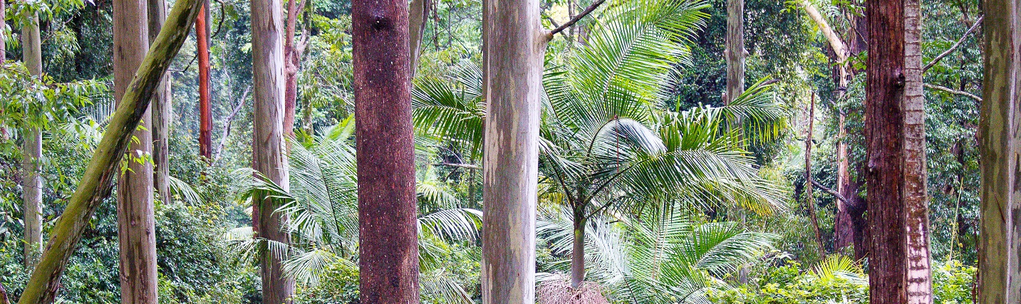
NSW contains a great variety of native vegetation, including some outstanding areas of rainforests, eucalypt forests and woodlands, grasslands, wetlands, coastal heaths, alpine habitats and arid shrublands. Native vegetation provides essential habitat for plant and animal species, and is an integral component of healthy, functioning ecosystems.
The extent and condition of native vegetation are broad indicators of ecosystem health and diversity (Saunders et al. 1998). The description of vegetation in NSW in this topic draws on generalised mapping based on vegetation structure and growth form. This provides a useful overview for reporting on the statewide status and extent of native vegetation. More detailed vegetation mapping that is based on vegetation communities and species composition and hence more descriptive of ecosystems and habitats is not yet available on a consistent basis across the State.
This topic is only concerned with the state of land-based vegetation. Freshwater aquatic vegetation is considered in the River Health and Wetlands topics, and coastal and marine vegetation is considered in the
topic.
Status and Trends
Vegetation extent
Information on the extent of native vegetation in NSW was compiled under the NSW Natural Resources Monitoring Evaluation and Reporting Strategy 2010–2015 (DECCW 2010) by combining vegetation mapping with remote sensing analysis (Dillon et al. 2011). The extent of native vegetation was described according to four categories of vegetation extent, representing various degrees of modification of native vegetation. A summary of the outcomes of this analysis is displayed below in Table 13.1.
Table 13.1: Extent of native vegetation in NSW
| Vegetation extent category | Description | Area (% of State) |
|---|---|---|
| Native – intact | Native vegetation in which the structure has not been substantially altered | 61% |
| Native – derived | Vegetation that is predominantly native but is no longer structurally intact as it has been substantially altered and is missing important structural components or layers | 8% |
| Native/non-native mosaic | Vegetation that cannot be classified as native or non-native using current remote sensing technologies | 20% |
| Non-native/other | Non-native vegetation (crops, plantations, pasture) or other non-vegetative land cover | 11% |
Extent of intact native vegetation
‘Native – intact’ vegetation covers 61% of NSW. This category describes vegetation communities that occur naturally and are structurally intact, so they can still be readily identified as native vegetation communities (Keith & Simpson 2006; Keith & Simpson 2008).
However, these communities are not all in good condition. About 15% of this native vegetation (or 9% of NSW) is regarded as being in a state that is close to natural, as it is managed with conservation as the primary objective. The condition of the remaining 85% of vegetation in this category (or 52% of NSW) has deteriorated due to the impacts of various land uses.
The extent to which different vegetation types (formations or classes) remain intact is due to the differing rates of clearing, largely historical, that have occurred across various parts of the State. Generally, flat productive lands have been favoured for development, with particularly high rates of clearing in native grasslands, grassy woodlands, some types of wetlands and eucalypt forests. Some other native vegetation formations, such as arid shrublands and alpine areas, occur on land that is less attractive for development, so have experienced little change in extent. The status of intact native vegetation formations in NSW is summarised in Table 13.2 below.
Table 13.2: Extent of clearing of native vegetation formations in NSW since 1750
| Vegetation formation | Status |
|---|---|
| Native grasslands | Extensively cleared or modified with only small fragments remaining outside the semi-arid zone, although some grazing lands retain important remnants |
| Grassy woodlands | Substantially depleted with less than 10% of some classes remaining |
| Rainforests | Littoral rainforests and those on coastal lowlands have been substantially reduced. Other classes of rainforests occurring in more rugged terrain are less depleted, although changes in structure and species composition have occurred in areas with a history of timber harvesting |
| Dry sclerophyll forests | Less cleared, because of constraints imposed by terrain and less fertile soils, although levels of depletion are still substantial in some classes |
| Wet sclerophyll forests | Less cleared, because of constraints imposed by terrain and less fertile soils, although levels of depletion are still substantial in some classes |
| Semi-arid woodlands | Have undergone low to moderate levels of clearing (10–60%), although this has increased in recent decades |
| Arid shrublands | Still largely intact as they are generally less suitable for development |
| Heathlands | Still largely intact as they are generally less suitable for development |
| Alpine complex | Still largely intact as they are generally less suitable for development |
The remaining vegetation extent categories listed in Table 13.1 (39% of NSW) describe vegetation that has been extensively modified, so that while native it no longer forms a natural community, or is non-native, or there is no vegetation cover at all.
Vegetation condition
Where native vegetation has not been cleared, its condition varies from close to natural if undisturbed, to degraded where it has been heavily disturbed. The condition of native vegetation has been modified to varying degrees by the effects of land management practices and unplanned threats such as weed invasion, drought and fire. The impacts of these threats include:
- changes to the structure, ecological function and species composition of native vegetation
- lower rates of regeneration and reduced vigour
- prevalence of parasites, pathogens and diseases
- presence of weeds and pests.
The combined effect of these impacts is diminished habitat values and impaired ecosystem processes. Declines in vegetation condition are generally less immediately visible than clearing and tend to occur over longer timeframes, making them more difficult to monitor and assess.
The condition of vegetation is often used as a broad indicator of habitat quality. However, the traditional framework for describing vegetation in terms of its extent and condition is not sufficient to provide an effective assessment of habitat quality (Tulloch et al. 2018). An alternative approach for assessing habitat quality in NSW is presently being developed.
Pressures
Pressures on vegetation extent
Land clearing
Clearing is recognised as the main threat, not only to the extent of native vegetation cover, but also, due to the ongoing effects of fragmentation, to its condition.
Native vegetation has been extensively cleared in some parts of NSW for settlement, industry and agriculture. Clearing occurs to enable changes in land use and it is generally irreversible, due to the ongoing nature of subsequent land uses. Clearing displaces many native animals and plants and has a negative impact on biodiversity. Over time, the effects of fragmentation and disturbance lead to invasion by weeds and further deterioration in the condition and habitat values of the remnant vegetation.
Clearing of native vegetation, and the destruction of habitat that is associated with it has been identified as the single greatest threat to biodiversity in NSW (). Land clearing is also listed as a key threatening process under the Biodiversity Conservation Act 2016.
Clearing of woody vegetation
For 23 years up to 2011, the clearing of woody vegetation in NSW was monitored by analysing Landsat remote sensing data using the Statewide Landcover and Trees Study (SLATS) processing methodology (DNRW 2007). Due to the failure of the Landsat 5 satellite in November 2011 this monitoring was replaced by the analysis of SPOT 5 data from 2009–10 onwards, using the same methodology. There were two years of overlap, where data were available for comparison from both platforms.
Woody vegetation change based on Landsat imagery had a 30-metre resolution. This led to a definition of woody vegetation as being woody communities that are taller than about two metres and have 20% or more canopy cover (e.g. woodlands open forest and closed forest). SPOT 5 imagery has a finer resolution at five metres and hence provides more detailed mapping. It can monitor woody vegetation down to 5% canopy cover, enabling changes in tree cover to be detected in open woodlands, grasslands with scattered trees and highly modified areas.
Comparison of the estimates of change in woody vegetation derived from the two platforms shows that SPOT 5 imagery detects more and smaller changes than Landsat, while Landsat tends to overestimate change due to the coarser resolution. Due to this variability, clearing rates derived from the two platforms are not directly comparable.
Figure 13.1 presents SPOT 5 data on the changes in woody vegetation due to clearing for agriculture and infrastructure development and harvesting due to forestry operations over the six years of monitoring up to 2014–15.
Figure 13.1: Loss of woody vegetation in NSW, 2009–10 to 2014–15
Notes:
There is some variability in the actual length of the yearly intervals, depending on the availability of remote sensing data suitable for analysis, due to seasonal factors.
The estimate of clearing provided in this report relates only to activities that lead to permanent changes in land use, that is, changes due to agriculture and infrastructure development. Forestry operations are not described as clearing because they do not lead to land use change. Most timber harvesting areas are expected to be regenerated as regrowth forest.
The six years of SPOT 5 data to 2014–15 displays a relatively stable pattern of clearing at about 12,300 hectares per year on average. The unusually low result in 2010–11 is attributed to a particularly wet year, affecting the ability to conduct broadscale clearing operations. The clearing rate for 2014–15, the final year of available data is 14,700 hectares, slightly higher than the six-year average.
The overall pattern is also consistent with the last seven of the 23 years of Landsat data available, which also displayed a relatively stable pattern from about 2004 onwards.
The monitoring of increases in woody vegetation, mainly due to revegetation, is more complex than the monitoring of clearing. A methodology is being developed to measure such change and estimates of revegetation should be available for future reporting.
Clearing of non-woody vegetation
Non-woody vegetation is vegetation that does not meet the criteria to be classified as woody vegetation, described earlier in this topic. It refers to all grasslands and large areas of open woodlands and arid shrublands characteristic of western NSW.
In 2012, the vegetation extent data described previously in Table 13.1 were combined with the current (2011) map of woody vegetation change to determine how much woody vegetation there was in each extent category (EPA 2012). This analysis is summarised in Table 13.3.
Table 13.3: Extent of woody native vegetation in NSW in 2011–12
| Vegetation extent category | Area (% of State) |
Proportion woody (%)* |
|---|---|---|
| Native – intact | 61% | 55% |
| Native – derived | 8% | 50% |
| Native/non-native mosaic | 20% | 15% |
| Non-native/other | 11% | – |
| Total | 100% | 45% |
Notes:
* This describes the percentage of each category that is woody and the figures do not sum to 100%. Overall, 45% of all native vegetation was categorised as woody.
While 55% of intact native vegetation category is woody, only 45% of all native vegetation in NSW is woody. Clearing of woody vegetation therefore only accounts for about a half of all native vegetation.
However, not all clearing occurs by directly removing trees in areas of woody vegetation, so the clearing of non-woody vegetation is harder to monitor. Much of the native grassland in NSW has been cleared or modified by:
- the process of pasture improvement
- the application of fertilisers
- the ploughing and sowing of introduced grasses and clovers.
Some arid shrublands have, in effect, also been cleared through prolonged overgrazing, and some freshwater wetlands by drainage works.
Pressures on vegetation condition
Land use
The level of disturbance of natural systems and impact on the condition of native vegetation increases with intensifying land use. A framework for land use mapping is described in Guidelines for Land Use Mapping in Australia: Principles, procedures and definitions (ABARES 2011). These land uses have been reclassified into five pressure categories according to the intensity of the operations associated with different land uses. The extent of vegetation in the different categories is summarised in Table 13.4.
Table 13.4: Land-use pressure on native vegetation
| Category | Description | Area (% of State) |
|---|---|---|
| Conservation and natural environments | Land set aside primarily for conservation, where natural ecosystems are maintained | 18% |
| Relatively natural environments | Land used primarily for agriculture, with limited changes to native vegetation | 40% |
| Dryland agriculture and plantations | Land used mainly for agriculture, based on dryland farming | 38% |
| Irrigated agriculture and plantations | Land used mostly for agriculture, based on irrigated farming | 2% |
| Intensive uses | Land subject to extensive modification, generally in association with residential settlement, or commercial or industrial uses | 2% |
However, it should be noted that the intensity of land use can be moderated by the specific land management practices adopted in carrying out a land use.
Other pressures
Pressures other than land use also have an impact on the condition of native vegetation. These include:
- the longer-term effects of fragmentation after clearing
- invasive species (especially weeds and plant pathogens)
- altered fire regimes
- soil degradation
- overgrazing
- changes to water regimes
- the emerging effects of climate change.
Fragmentation
Habitat fragmentation caused by land clearing continues to have long-term impacts on native vegetation well after the initial clearing occurs, including:
- the dieback of vegetation and lack of regeneration
- invasion by weeds and feral animals
- loss of native species and variability.
Overgrazing
While most arid shrublands and grasslands are not subject to extensive clearing, they are affected by overgrazing. This is due to the cumulative impact of native species, farm stock and feral animals. The effects of overgrazing are often compounded by cycles of drought. Overgrazing reduces the cover of ephemeral plants, simplifies fauna habitat and promotes an overabundance of species which are less palatable to grazing animals.
Altered fire regimes
Altered fire regimes – too much or too little burning or burning at too high an intensity – affects regeneration and alters the composition of vegetation communities. Some native species require a level of fire to stimulate regeneration, but too much fire supresses this regeneration.
Climate change
Climate change is a pervasive threat that is expected to have increasing effects on all types of native vegetation in NSW. Alpine vegetation, wetlands and rainforests are likely to be especially sensitive (Laurence et al. 2011). The continuing reduction of snow cover in alpine areas (Nicholls 2009) is decreasing the area and suitability of habitat for a range of specialised alpine species (Green & Pickering 2009).
Some of the pressures on the condition of native vegetation are described in more detail in other topics of this report, including:
- changes to water regimes (see the River Health and Wetlands topics)
- soil degradation (see the Soil Condition topic)
- invasive species (see the Invasive Species topic)
- climate change (see the Climate Change topic).
Responses
Legislation and policies
Biodiversity Conservation Act
Biodiversity legislation in NSW has been consolidated under the Biodiversity Conservation Act 2016 (BC Act), which replaces the Threatened Species Conservation Act 1995, Nature Conservation Trust Act 2001 and the plant and animal provisions of the National Parks and Wildlife Act 1974. A new rural land management framework was also introduced with the Local Land Services Amendment Act 2016, which replaced the Native Vegetation Act 2003. The new laws commenced on 25 August 2017
Programs
Biodiversity Offsets Scheme
A new biodiversity offsets framework was introduced with the BC Act. The Biodiversity Offsets Scheme establishes a framework to avoid, minimise and offset the impacts on biodiversity from development or clearing. It simplifies assessment and improves biodiversity outcomes by creating consistent requirements for the assessment of biodiversity at development and offset sites.
Under the Biodiversity Offsets Scheme, offset sites must be secured using Biodiversity Stewardship Agreements, which are voluntary in-perpetuity agreements between a willing landholder and the Minister for the Environment. Stewardship agreements generate biodiversity credits, representing the gain in biodiversity achieved by protecting and managing the land.
The BC Act also establishes a scheme for the biodiversity certification of land which strengthens and improves the previous certification framework. Biodiversity certification offers planning authorities a streamlined process for assessing biodiversity in areas marked for development at the strategic planning stage. These areas can be avoided and protected while identifying areas more suitable for development. Certification offers a range of secure options for offsetting impacts on biodiversity.
Biodiversity Assessment Method
The Biodiversity Assessment Method (BAM) was established to support the Biodiversity Offsets Scheme by providing:
- a consistent method for assessing of biodiversity on a proposed development or State significant project, or clearing site
- guidance on ways in which a developer or farmer can avoid and minimise potential biodiversity impacts
- the number and class of biodiversity credits that need to be offset to achieve a standard of ‘no net loss’ of biodiversity.
The BAM assesses the biodiversity value of land and calculates likely losses resulting from the clearing of native vegetation and habitat destruction. It also calculates gains from conserving native vegetation and actively managing land for conservation as a stewardship site.
Biodiversity Values Map
The Biodiversity Values Map identifies land with high biodiversity values in NSW that could be affected by future development and helps determine whether proposed development or clearing activities require offsets.
Eleven types of land may be considered in the Biodiversity Values Map, including:
- coastal wetlands and littoral rainforest as per the Coastal Management Act 2016
- core koala habitat identified in a plan of management under State Environmental Planning Policy No. 44—Koala Habitat Protection (SEPP 44)
- Ramsar wetlands as defined by the Environmental Protection and Biodiversity Conservation Act 1999 (Commonwealth)
- land that contains threatened species or threatened ecological communities identified as species vulnerable to serious and irreversible impacts under Section 6.5 of the BC Act
- protected riparian land
- high conservation value grasslands or groundcover
- old growth forest
- rainforest
- declared areas of outstanding biodiversity value
- council nominated areas with connectivity or threatened species habitat that the Environment Minister considers will conserve biodiversity at bioregional or state scale
- any other land that is of sufficient biodiversity value to be included.
Biodiversity Conservation Trust
The NSW Biodiversity Conservation Trust (BCT) is a not-for-profit statutory body that was constituted with the commencement of the BC Act. The work of the BCT is guided by its Business Plan for 2017–18 to 2020–21, approved by the Minister for the Environment and the Biodiversity Conservation Investment Strategy 2018.
The BCT was established to support and encourage landholders to protect and conserve biodiversity on private land. The BCT is delivering $240 million over the five years to 2020–21, and $70 million per annum (escalated) thereafter, subject to reviews of its performance.
The BCT works in partnership with landholders to establish private land conservation agreements to conserve and manage high-value biodiversity on private land. Three types of voluntary private land conservation agreements are available to landholders:
- biodiversity stewardship agreements (BSAs)
- conservation agreements
- wildlife refuge agreements.
Landholders who enter voluntary agreements to conserve and manage biodiversity can access a range of funding programs, subject to eligibility criteria, that may help to diversify their income streams, with potential for long-term annual payments. Further details on the operation and uptake of private land agreements are provided in the topic.
The NSW BCT plays a key role in the delivery of the Biodiversity Offsets Scheme. Proponents can choose to satisfy offset obligations in the consent conditions to their development approval by paying money into the Biodiversity Conservation Fund managed by the NSW BCT. Once a payment is made into the fund, the BCT is responsible for finding the offsets needed. This is achieved by purchasing biodiversity credits (generated under biodiversity stewardship agreements) or funding biodiversity conservation actions that benefit species impacted by the development.
The BCT assists landholders who wish to enter BSAs to generate and sell biodiversity credits and administers those agreements.
Land management
Land management reforms were introduced with the Local Land Services Amendment Act 2016 to regulate clearing of vegetation and to protect threatened species or ecological communities.
The clearing of native vegetation for everyday land management activities such as constructing and maintaining rural infrastructure (including fence lines, dams, sheds and tracks) is permitted under the Act. However, there are requirements to minimise impacts on native vegetation and, where possible, to co-locate infrastructure. Land with threatened species or ecological communities present is more highly regulated than other land.
A new Land Management (Native Vegetation) Code has been introduced to help landholders manage their land sustainably and ensure more productive farming methods and systems while responding to environmental risks. The Code sets out clearing parameters and requirements to offset the impacts of clearing.
Native Vegetation Regulatory Map
A Native Vegetation Regulatory (NVR) Map is being developed to underpin the new land management framework. The NVR Map shows rural land where clearing of native vegetation can occur without approval and land where clearing requires approval.
Land is categorised based on the ecosystems present and their condition, as:
- unregulated (unrestricted) land that can be cleared without approval
- regulated land managed under the Land Management (Native Vegetation Code)
- vulnerable regulated land
- sensitive regulated land
- excluded land.
Landholders can request a report which explains the basis for including their land in any category on the NVR Map or seek a review of their property if they consider their land has been incorrectly categorised.
A new State Environmental Planning Policy (Vegetation in NonRural Areas) 2017 (SEPP) regulates clearing not covered by the Local Land Services Act 2013 (LLS Act). The SEPP applies to the Sydney and Newcastle metropolitan areas, and to all other land in NSW that is zoned for urban purposes or for environmental conservation/management under the Standard Instrument – Principal Environmental Plan. It regulates clearing of:
- native vegetation above the offset threshold, where a proponent will require an approval from the Native Vegetation Panel established under the LLS Act
- vegetation below the offset threshold, where a proponent requires a permit from council as the vegetation is identified in the council’s Development Control Plan (DCP).
For clearing proposals that do not fall under the allowable activities of the Land Management (Native Vegetation) Code, an approval process has been established by the Native Vegetation Panel to enable landholders to offset the biodiversity impacts of developing their land.
Management of native vegetation
Since 2006, the NSW Government has compiled data on native vegetation programs from various agencies to produce the NSW Report on Native Vegetation (OEH 2018), including the native vegetation report card. (Updates of this data as they become available can be found on the Office of Environment and heritage website). The report card compiles figures on the range of activities conducted to manage native vegetation in NSW since 2005–06. These numbers are summarised for the period 2005–6 to 2015–16 in Table 13.5 below.
Table 13.5: Summary of native vegetation management activities undertaken in NSW from 2005–06 to 2015–16
| Category | Description | Total area (ha) - Last 2 years (2014–15 to 2015–16) | Annual average (ha) - (2005–6 to 2015–16) | Total area (ha) - (2005–6 to 2015–16) |
|---|---|---|---|---|
| New conservation areas | New public reserves or additions as well as private conservation areas (see topic) | 74,560 | 124,620 | 1,370,830 |
| New restoration or revegetation of native vegetation | Revegetation or rehabilitation of native vegetation, as part of incentives, wildlife refuges, or retained and improved as a condition to clear under Property Vegetation Plans | 234,410 | 261,250 | 2,873, 800 |
| New management of native vegetation | Management through Invasive Native Scrub, Thinning and Private Native Forestry Property Vegetation Plans, new areas of public forest, weed removal programs, and management to reduce grazing pressure | 1,184,120 | 783,530 | 8,618,820 |
| New approvals for clearing of native vegetation | Approved clearing under NSW legislation including the Biodiversity Conservation Act 2016; former Native Vegetation Act 2003 and Native Vegetation Conservation Act 1997; Plantations and Reafforestation Act 1999 | 10,120 | 3,660 | 40,250 |
The first three categories describe activities that result in positive changes in the extent or condition (or both), of native vegetation. The last category describes approved losses in the extent of vegetation.
In general, the total area of land being conserved, restored or undergoing improved management is substantially greater than the area approved for clearing. However, it is still too early for many of the measures listed in Table 13.5 to be detectable as changes in the overall extent or condition of native vegetation, described earlier in this topic.
The new clearing approvals category describes consent for clearing applications. These do not necessarily reflect the actual levels of clearing described in Figure 13.1 above, as the clearing detected may be approved, exempt from approval, or illegal. Clearing approvals also apply for 15 years, so the clearing may not occur in the year of approval.
Figure 13.2 shows that clearing approvals in 2015–16 totalled about 7,400 hectares. Approvals in the previous nine years to 2014–15, were between 1,000 and 3,000 hectares per annum.
Figure 13.2: New approvals for clearing 2005–06 to 2015–16
Future opportunities
More regional programs involving local communities should provide greater opportunities to improve vegetation condition, enhance habitat connectivity and reduce fragmentation. Over time, this should increase the resilience, health and productivity of native vegetation on public and private land.
The pressures that affect vegetation condition are likely to continue in the foreseeable future, due to further weed invasion and new weed incursions, the effects of plant diseases and pathogens, changes to fire regimes and the effects of climate change.
References
References for Native Vegetation
ABARES 2011, Guidelines for Land Use Mapping in Australia: Principles, procedures and definitions, 4th edn, Australian Bureau of Agricultural and Resource Economics and Sciences, Canberra [www.agriculture.gov.au/abares/aclump/land-use/mapping-technical-specifications]
Coutts-Smith AJ & Downey PO 2006, Impact of Weeds on Threatened Biodiversity in New South Wales, Technical Series no.11, CRC for Australian Weed Management, Adelaide [www.southwestnrm.org.au/ihub/impact-weeds-threatened-biodiversity-new-south-wales]
DECCW 2010, NSW Natural Resources Monitoring, Evaluation and Reporting Strategy 2010–2015, Department of Environment, Climate Change and Water, Sydney [www.environment.nsw.gov.au/soc/20100977nrmmerstrat1015.htm]
Dillon M, McNellie M & Oliver I 2011, Assessing the Extent and Condition of Native Vegetation in NSW, Monitoring, Evaluation and Reporting Program, Technical report series, NSW Office of Environment & Heritage, Sydney [www.environment.nsw.gov.au/soc/20110713NativeVegTRS.htm]
DNRW 2007, Land Cover Change in Queensland 2004–2005: A statewide land cover and trees study (SLATS) report, Department of Natural Resources and Water, Brisbane
EPA 2012, New South Wales State of the Environment 2012, Environment Protection Authority, Sydney [www.epa.nsw.gov.au/soe/soe2012]
Green K & Pickering C 2009, ‘Vegetation, microclimate and soils associated with the latest-lying snow patches in Australia’, Plant Ecology & Diversity, vol. 2, no. 3, pp. 289–300 [dx.doi.org/10.1080/17550870903019275]
Keith DA 2004, Ocean Shores to Desert Dunes: The native vegetation of New South Wales and the ACT, Department of Environment and Conservation NSW, Sydney [summary at www.environment.nsw.gov.au/publications/ostdd.htm]
Keith DA & Simpson CC 2006, Spatial Data Layers for NSW Extant Native Vegetation, internal report, Department of Environment and Conservation NSW, Sydney
Keith DA & Simpson CC 2008, ‘A protocol for assessment and integration of vegetation maps, with an application to spatial data sets from south-eastern Australia’, Austral Ecology, vol. 33, no. 6, pp. 761–74 [dx.doi.org/10.1111/j.1442-9993.2008.01844.x]
Laurence WF, Dell B, Turton SM, Lawes MJ, Hutley LB, McCallum H, Dale P, Bird M, Hardy G, Prideaux G, Gawne B, McMahon CR, Yu R, Hero JM, Schwarzkopf L, Krockenberger A, Douglas M, Silvester E, Mahony M, Vella K, Saikia U, Wahren C, Xu Z, Smith B & Cocklin C 2011, ‘The 10 Australian ecosystems most vulnerable to tipping points’, Biological Conservation, vol. 144, no. 5, pp. 1472–80 [dx.doi.org/10.1016/j.biocon.2011.01.016]
Nicholls N 2009, ‘Estimating changes in mortality due to climate change’, Climatic Change, vol. 97, no. 1–2, pp. 313–20 [dx.doi.org/10.1007/s10584-009-9694-z]
OEH 2018, NSW Report on Native Vegetation 2014–16, Office of Environment & Heritage, Sydney [www.environment.nsw.gov.au/research-and-publications/publications-search/nsw-report-on-native-vegetation-2014-2016]
Saunders D, Margules C & Hill B 1998, Environmental Indicators for National State of the Environment Reporting: Biodiversity, Department of the Environment, Canberra [www.environment.gov.au/soe/publications/indicators/biodiversity.html]
Tulloch A, McDonald J, Cosier P, Sbrocchi C, Stein J, Lindenmayer D & Possingham P 2018, ‘Using ideal distributions of the time since habitat was disturbed to build metrics for evaluating landscape condition’, Ecological Applications, vol. 28, no. 3, pp. 709–20 [https://esajournals.onlinelibrary.wiley.com/doi/abs/10.1002/eap.1676]